Sustainable Development though Eco-Planning, St. Louis
Case Study of the Meramec Sub-Watershed
MAUD Thesis | Washington University, St. Louis (2000)
The thesis aims to ground the notion of sustainability or sustainable development as interpreted in the field of ecological design, using a given a site along the Meramec River in St Louis County and a prescribed development program, in order to demonstrate an ecologically sensitive approach to design. This privately owned 62 acre site ispart of a larger watershed draining to the River slated for mixed used development consisting of 80 single family houses, a 200 room assisted living facility for the elderly, a 125 room hotel, a service station, retail and office buildings and two outlots 1.5 acres each. The study tries to build a theoretical framework to understand the different aspects of the problematic and how they are all tied up together as a system to aid the formulation of an appropriate intervention. The study in this process attempts to address a number of environment and development practice related issues, which emerge from the lack of congruence between the natural and manmade fabric of contemporary urban and suburban neighborhoods. The study primarily involves understanding the principles of landscape ecology at scales ranging from regional to local and ascertaining parameters through analysis and recombination of accepted methods to arrive at a methodology of ecological design. Thus the thesis, on the whole, tries to explore the relationship of design at the local site level to the analysis/ planning process at an overall level. It not only examines specific ecological issues as they relate to the process but also uses a set of explicit assumptions/ principles for ecologically sensitive design.
Various theories and principles existing in the field of ecological planning/development proposed or researched by theorists like Ian McHarg, Richard Forman, Fredrick Steiner etc. have been adopted for directing the research from the stage of formulating the relevant questions to that of finding appropriate answers to each one of them. The methodology adopted for the study has therefore been divided into the following stages, wherein the decisions made at each stage are based on either the guiding principles adopted or on factual data collected which further informs the next stage of the process:
- Construction of a theoretical framework to ground the theories of sustainability using the methods defined within the field of ecological planning taking the watershed as a unit for ecological planning.
- Following the establishment of the framework for defining the various scales on which the site and its context need to be understood, the McHargian layer cake model is adopted to analyze the site at the regional, landscape and local watershed level using secondary data sources.
- The different layers of the interpreted information are then overlaid in order to develop a comprehensive suitability map which grades the entire watershed area into zones varying from the least to the most suitable both in terms of the land use type and scope for building.
- This suitability analysis is combined with the programmatic and strategic response to the site context and translated into an illustrative master plan for the sub-watershed area, based on certain design concepts and principles.
- The residential district outlined in the illustrative master plan is then further detailed out to demonstrate the actual spatial characteristics of the settlement in terms of how the built form relates to the surrounding landscape and how both compliment each other to give a definite character to the ‘place’.
- The detailed plan for the residential district is further substantiated by design of typologies for the built-form, streets and open spaces along with developing specific design guidelines for characterizing the development.

Diagramatic Master Plan

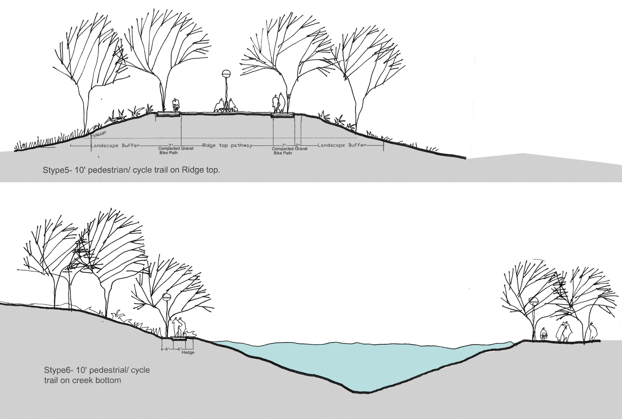
Bike Trail-Ridge Top and Creek Bottom Section

Residential District Paln


Residential District Street Sections